Printing Options
Printing OpenStreetMap Data
High-resolution Maps for Printing
When printing maps, the standard resolution used for screen display is often insufficient for high-quality results. Maps displayed on a monitor are optimized for on-screen viewing, not for printing, which requires a higher resolution to maintain clarity and detail.
If you print a map using the monitor's resolution, text may appear too small to read, or the map may look blurry. To solve this, the Omniscale OpenStreetMap WMS allows you to create maps optimized specifically for printing. Depending on your application, we provide two methods to generate high-resolution maps: adjusting DPI settings in the WMS request or using a dedicated print-optimized service.
DPI via WMS
Some applications allow you to include the desired print resolution directly in the WMS request. The software automatically transmits the requested resolution to the map service, and our service returns a map tailored to that resolution.
With this method, you can use our map service as usual without needing to change any additional settings. An example of an application that supports this functionality is QGIS.
Optimized Print Service
Other applications do not transmit the desired resolution to the map service. Instead, they simply increase the size of the requested map without changing the resolution. This means the map service cannot determine the user's intended print resolution.
For such cases, you need to use an optimized print service. This service can be added to your application as a standard WMS. The print service renders maps directly at a higher resolution. On your screen, labels and lines may initially appear oversized, but the printed output will match the desired quality. This behavior is illustrated in the screenshots below.
To use the optimized print service, add both the standard WMS and the print service to your application. Prepare your map with the standard WMS, and just before printing, switch to the print service.
Try the optimized print service using the following URL: https://maps.omniscale.net/v2/<your-api-key>/style.default/dpi.300/map?
You can request different resolutions by replacing 300 (DPI) in the URL with the desired value.
This approach is supported by all GIS and CAD applications, including:
- ESRI ArcGIS
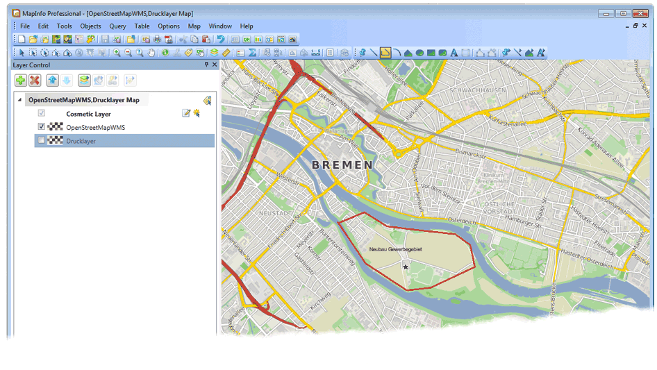
- Mapinfo Professional
Normal view
View of the optimized print service
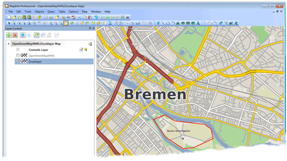
When printing with 300 DPI all labels and lines will appear in the same size as in the normal view. After printing, you can change back to the normal map service.